GPR is the general term for the geophysical method of using radar waves to image the subsurface. The Xradar™ technology and methodology allows you to scan the ground for subsurface objects in more detail than traditional GPR. It is commonly used in the construction, archaeology, earth sciences, and military sectors to name a few.
How does it work?
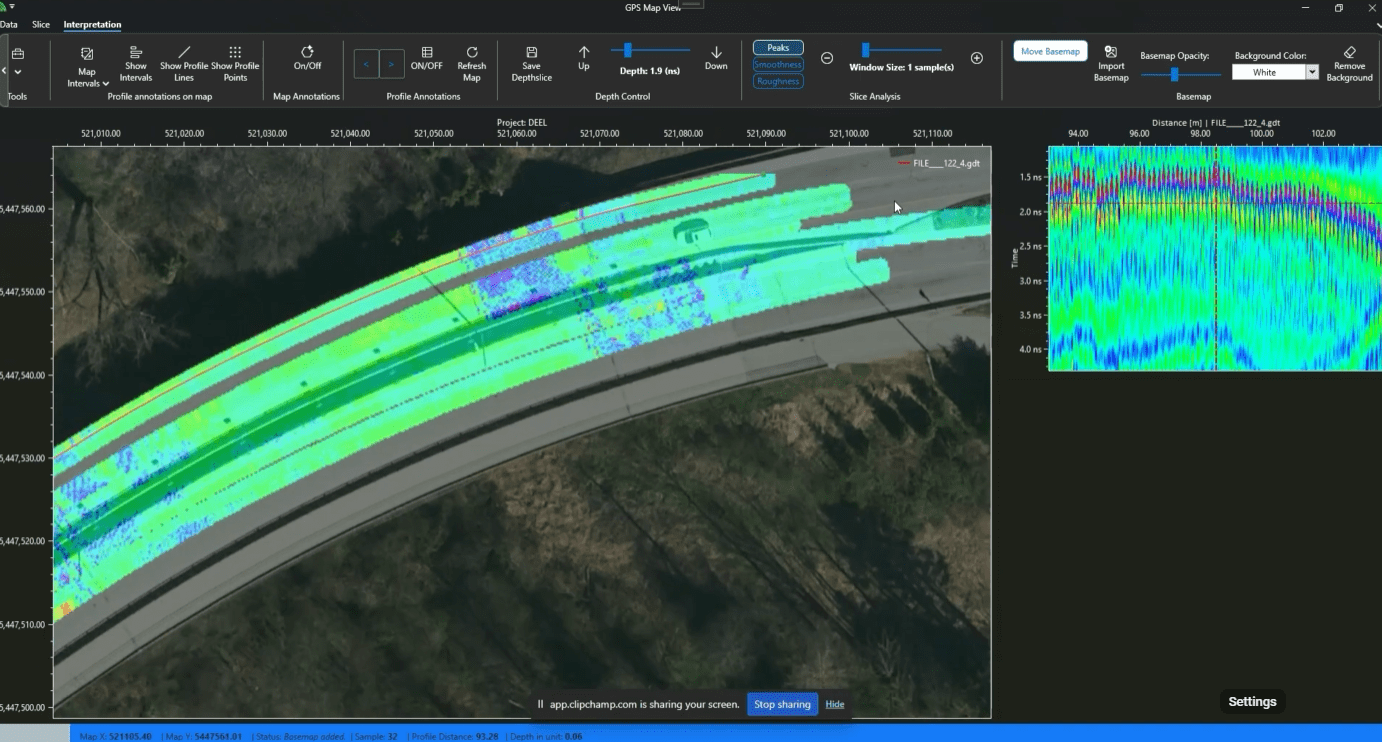
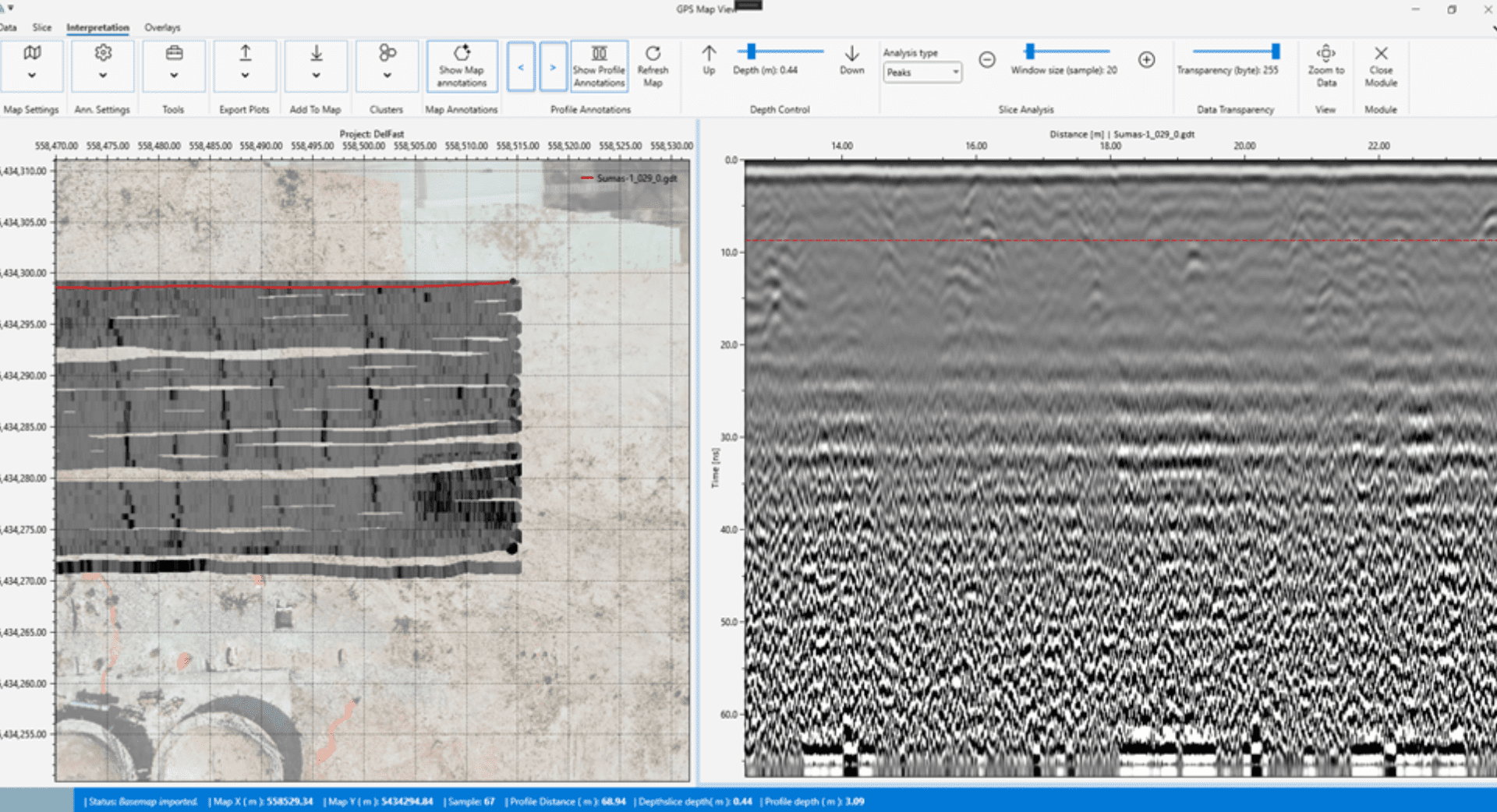
The process works by sending high-frequency electromagnetic waves into the ground from a transmitting antenna. As the waves are reflected back, they form an image of the subsurface.
Xradar™ can be used throughout a wide variety of materials including rock, soil, ice, water, pavements, and other structures. The waves are able to detect features which differ in their electrical properties of the surrounding material.
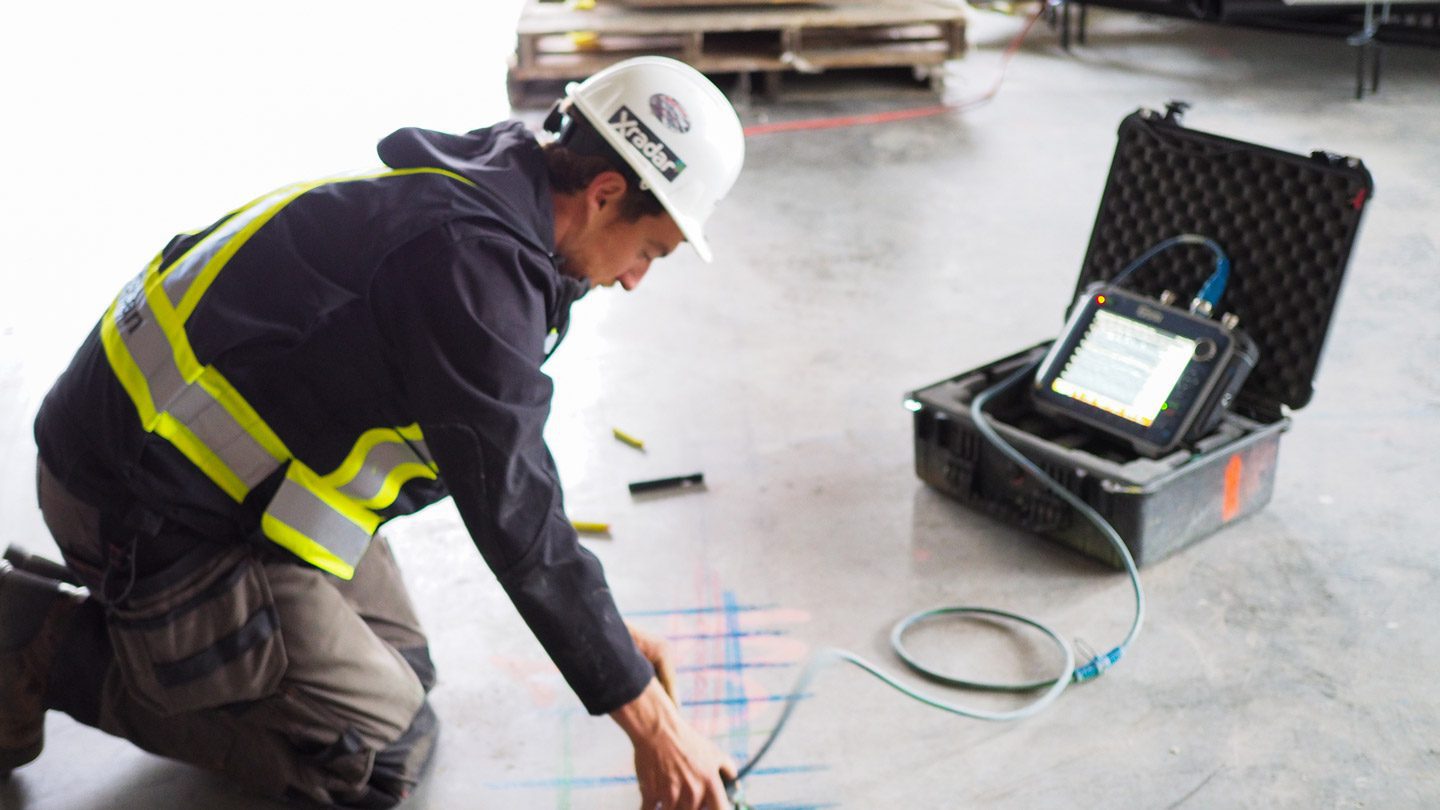
Xradar’s system utilises a control unit, a transmitter, and a receiver. As the transmitting antenna sends electronic waves through the ground, they are reflected back to the receiver, forming an image on the control unit.
Each Xradar technician is highly trained and can accurately interpret the data to form a clear picture of the subsurface. They then provide a detailed Engineering Report for the client, allowing them to safely assess their options. If other reports are required then the department has the capability to customise to the needs of the project.
Applications of Xradar™
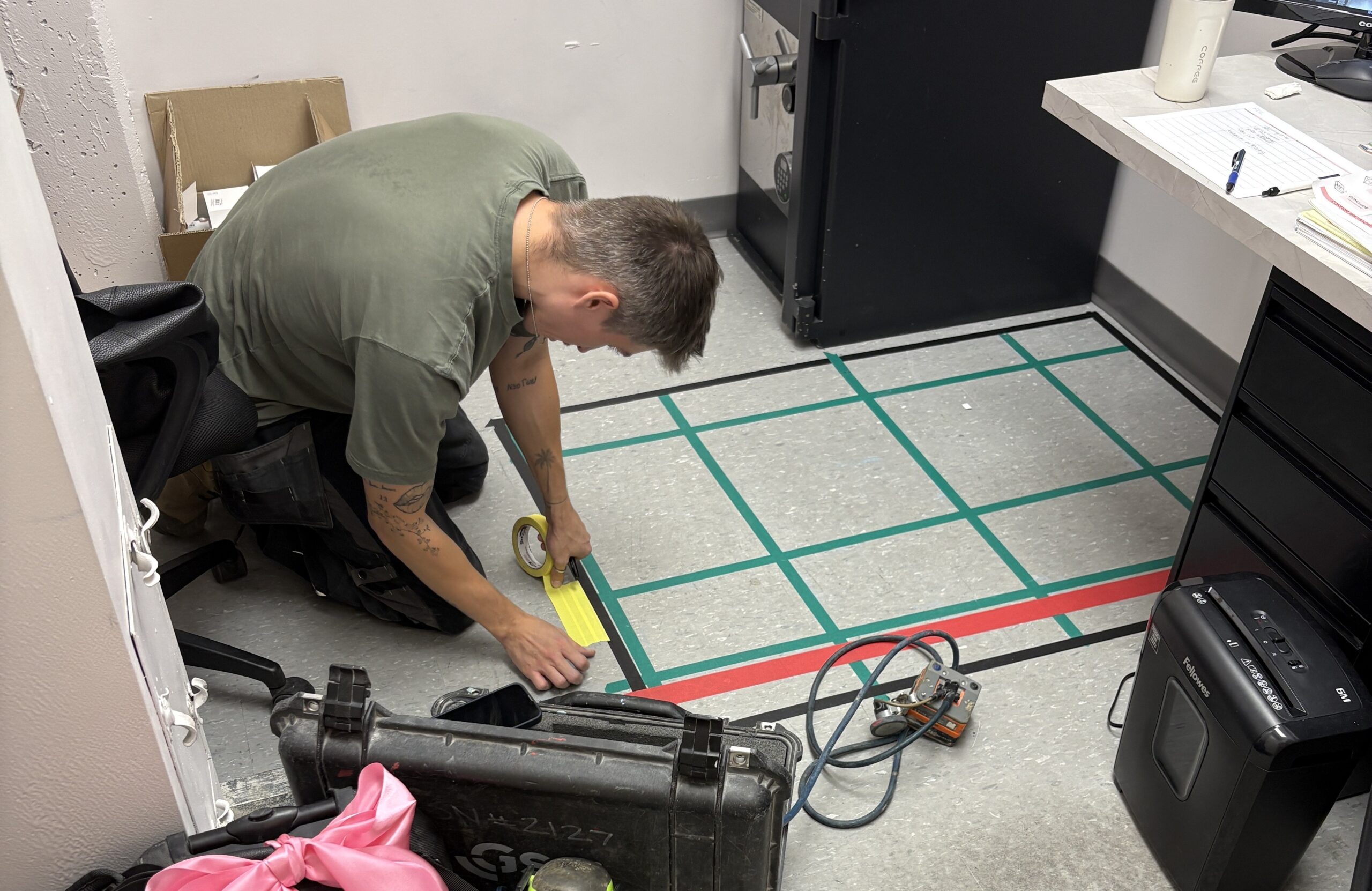
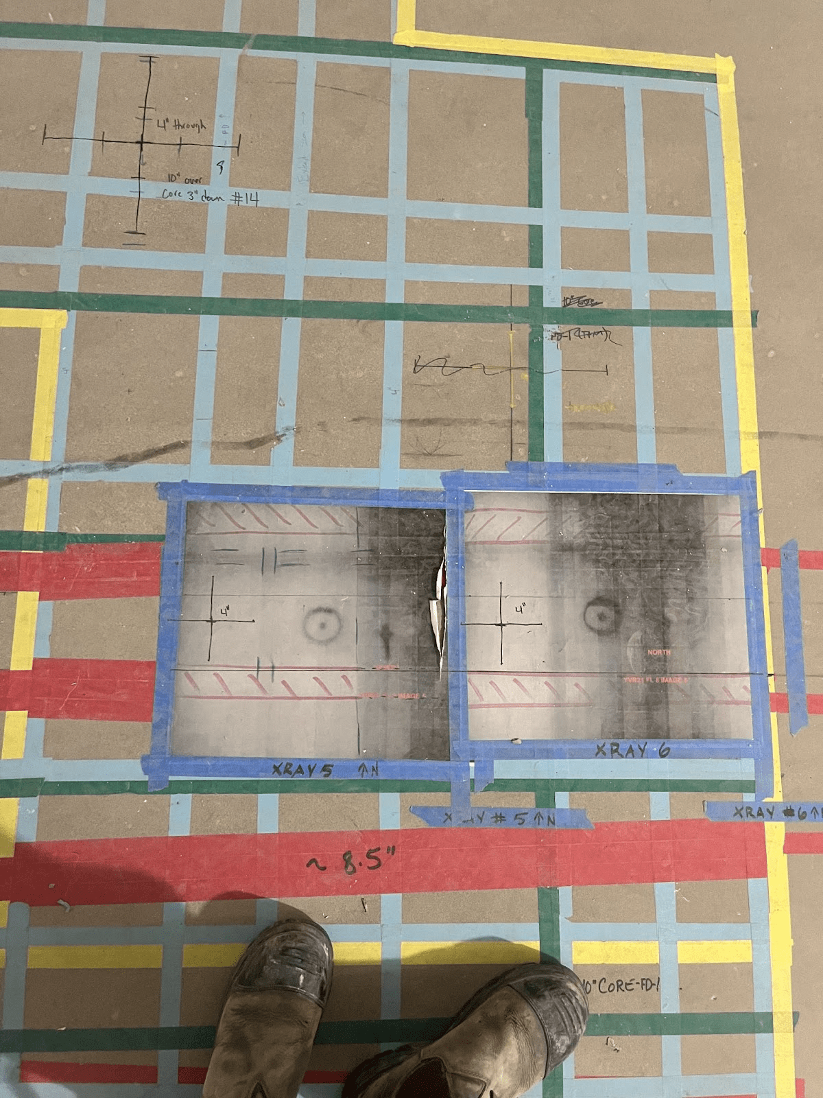
Xradar™ has applications in a wide range of fields. Most commonly it is used in construction and engineering as a form of non-destructive testing (NDT) on structures and pavements. Here it is known colloquially as “Concrete Scanning” and enables clients to accurately determine areas to cut and core, as well as locating things such as utilities and oil tanks.
Our services are also applied in Earth Sciences to study bedrock, soils, and groundwater, along with water table profiling. Archaeology is another industry that uses this accurate form of mapping in order to detect and map underground features and cemeteries.
Finally, another common use is in the fields of military and law enforcement, for the detection of dangerous objects such as landmines.
For more information on Xradar™ and how it can be applied to your industry, get in touch!