Virtual reality is bringing about radical transformations in almost every industry, and construction is no different. Xradar’s Pre-Design Concrete Scanning provides designers, architects, contractors and engineers with all the information they need to make informed decisions remotely using virtual site walkthroughs.
How does it work?
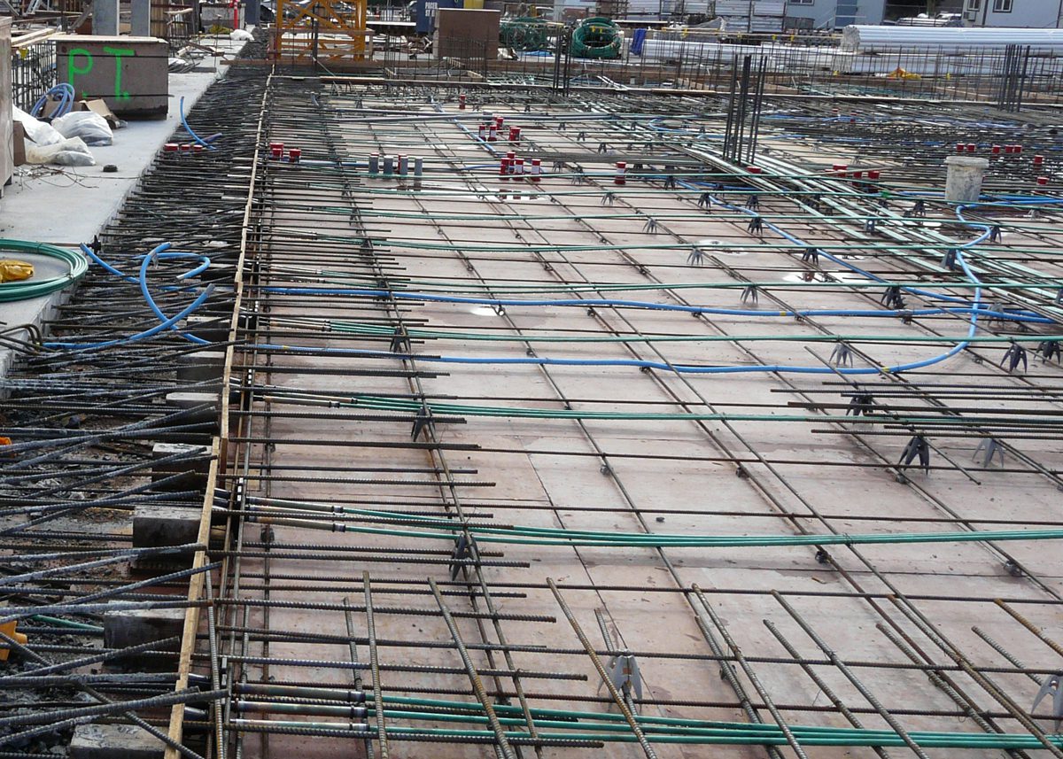
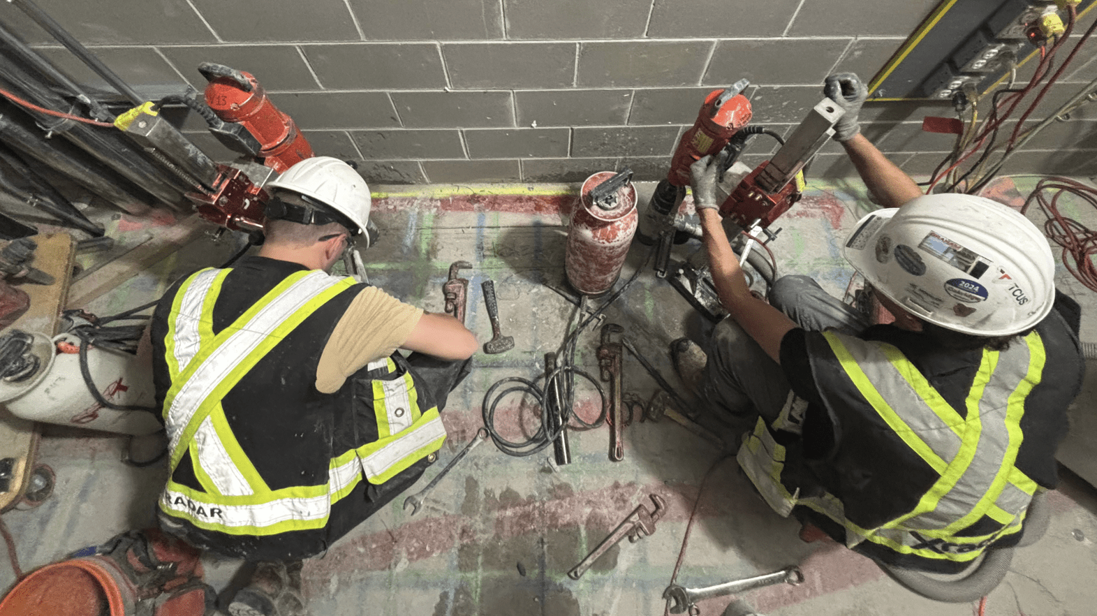
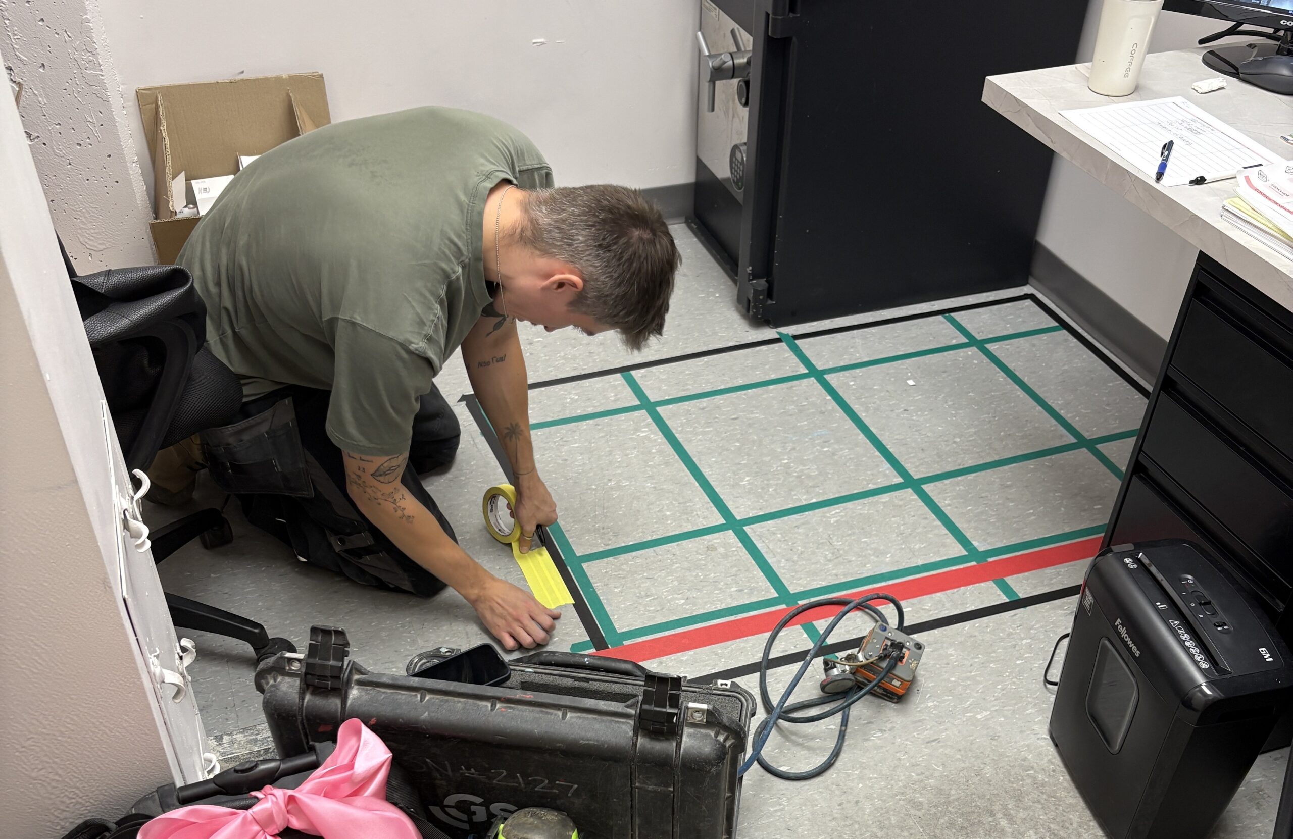
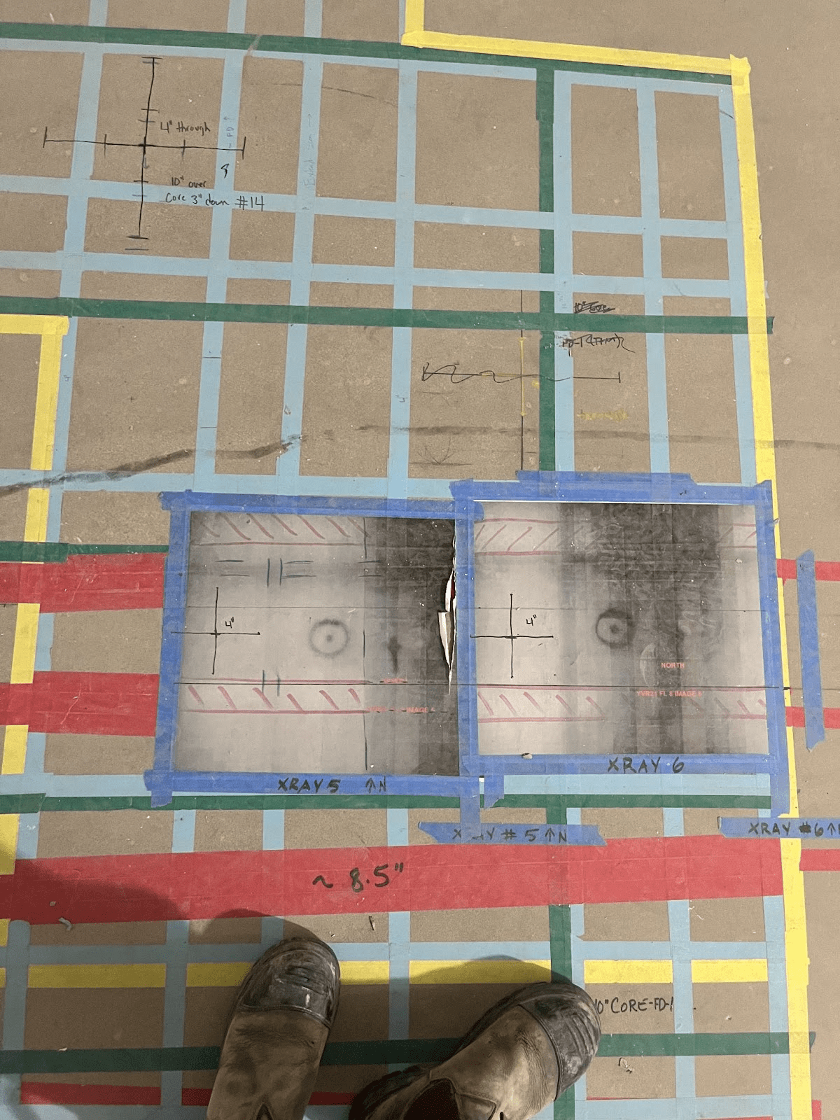
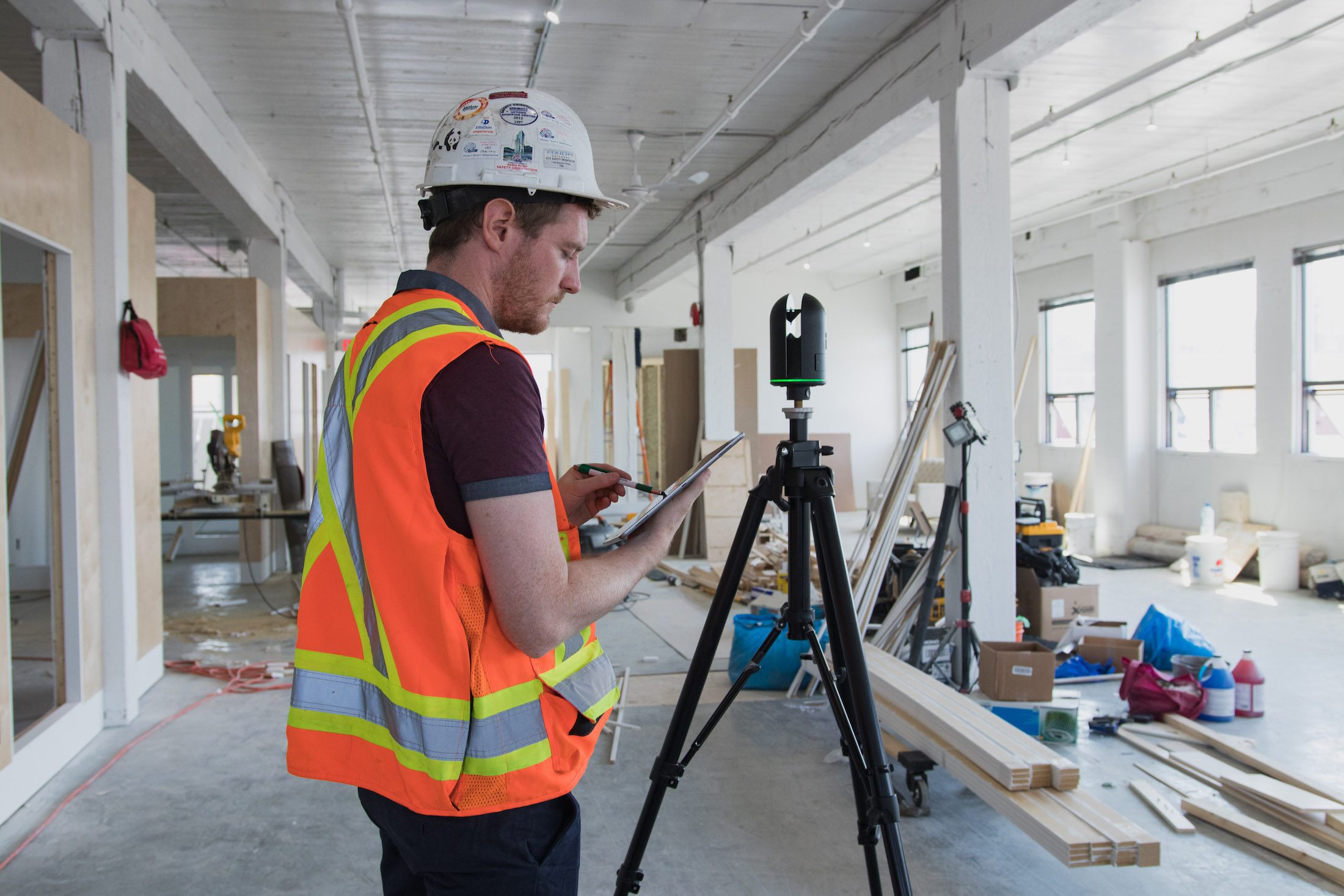
Prior to the interior design phase of a project Xradar™ scan the space using a 3D laser scanner. We then create a detailed and accurate as-built drawing which includes the locations of all the subsurface infrastructure.
The drawings can be exported in a range of formats including AutoCAD and Revit, along with a 3D virtual walkthrough of the actual space. These drawings can then be utilized by engineers or architects to create design drawings with zero conflicts. This smart space planning enables design teams to formulate ideas and evaluate design concepts without the requirement to revisit down the line.
What are the benefits of pre-design scanning?
The aim of pre-design scanning is to create a sustained link between the design and construction processes that will mitigate risk and improve both the speed and safety of the construction process.
With access to highly detailed as-built drawings designers and can create drawings with zero conflicts which allows you to avoid redesign costs and delays. Using the virtual walkthrough anyone can explore the location remotely and make decisions without the need for a site visit.
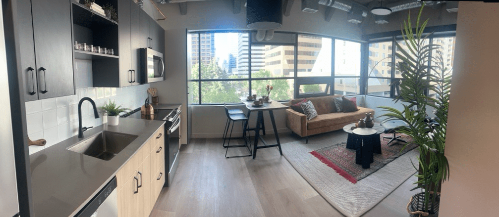
Using your virtual construction site walkthrough
In addition to exporting the as-built drawings we also provide our clients with a virtual site walkthrough. This walkthrough includes an overlay of the drawing as a reference point, along with the ability to explore any area of the site.
This service is popular with many of our concrete scanning clients who use it to make remote decisions following the scan of a site. In this walkthrough you can see the markings of the subsurface infrastructure that will potentially impeded the design of the space. The engineer is able to make an informed decision by utilizing the walkthrough and the drawing, meaning there is no need for a site visit.
Walkthroughs can be used by architects, interior designers, engineers, and across the construction industry. Capturing the project at each stage means that in-slabs targets can be documented during pre-pour, and overlaid on the finished site. 2D photography and 3D data from sites is also stitched together to create complete, immersive 3D models that can be annotated, shared and exported to programs such as Autodesk ReCap or Revit.
For more information on how virtual construction site walkthroughs can help your process, don’t hesitate to get in touch!