Enhanced Concrete Scanning Prevents Potential Mishap
Overview/Intro
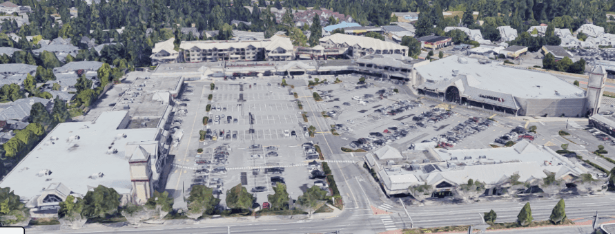
The client, a subcontractor on a commercial renovation at a local strip mall, required accurate scanning for trenching ahead of plumbing work. The client drawings indicated that the slab was slab-on-grade, typically designed for lighter loads without additional reinforcement. Based on this assumption, trenches were planned accordingly. However, during the scanning process, it was discovered that the slab was actually suspended, a critical oversight that could have had significant project implications.
The Challenge
The main challenge was the misidentification of the slab type. The client believed the slab was slab-on-grade, but it was actually a suspended slab situated above a parking structure. This misunderstanding threatened the building’s structural integrity if trenching proceeded based on incorrect assumptions. Misidentifying the slab type could lead to structural failure, increased project costs, and serious safety hazards for the onsite crew. Without an accurate assessment and corrective action, the client risked significant delays and costly rework.
Scope of Work
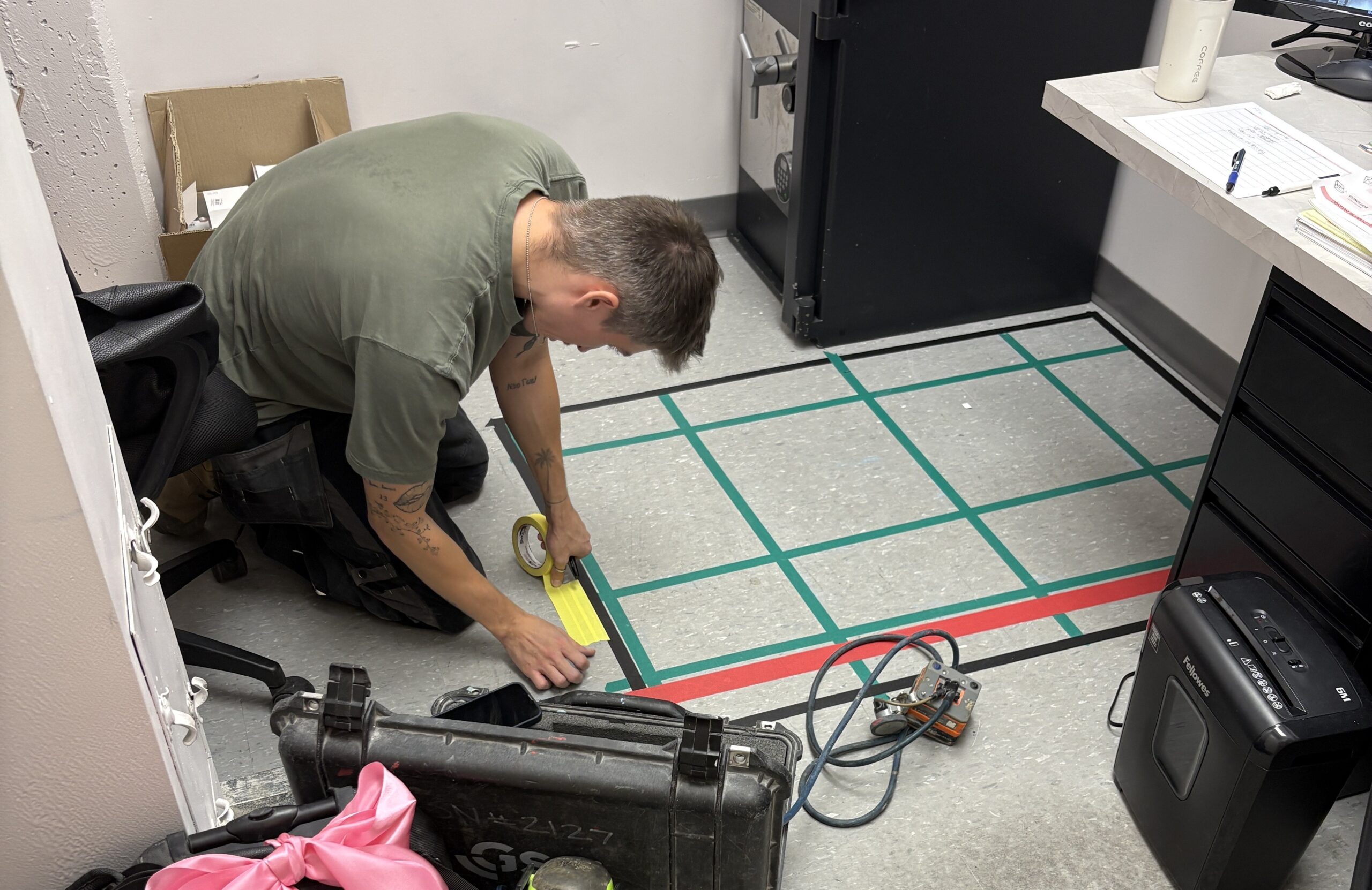
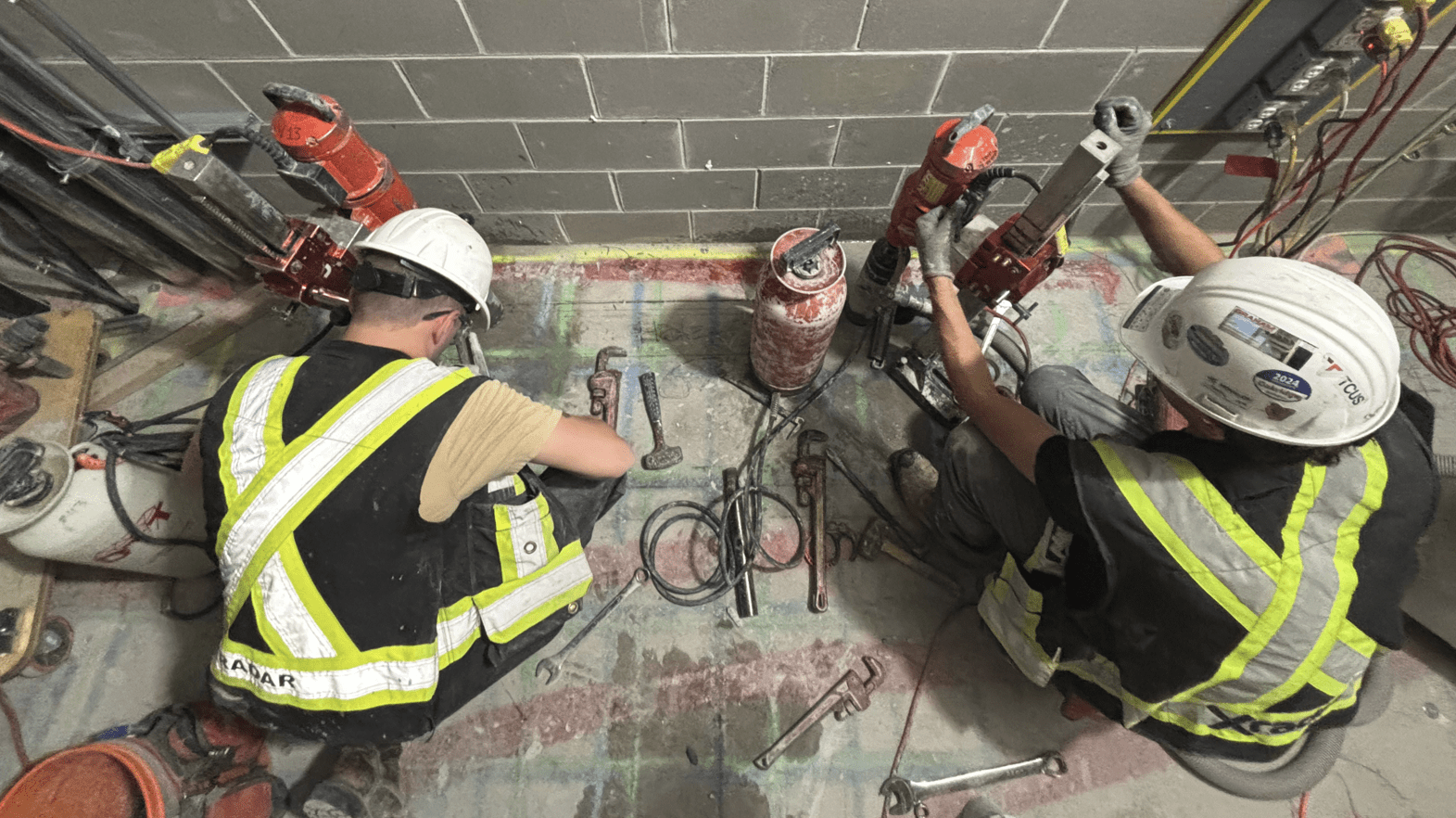
The scope of work included conducting a comprehensive GPR scan to locate rebar, conduits, and other subsurface features, along with an analysis to confirm the slab type.
The GPR scan focused on several trenches designated for plumbing, ensuring that no critical elements such as rebar, electrical conduits, or structural beams would be compromised during the planned excavation.
Our Solution
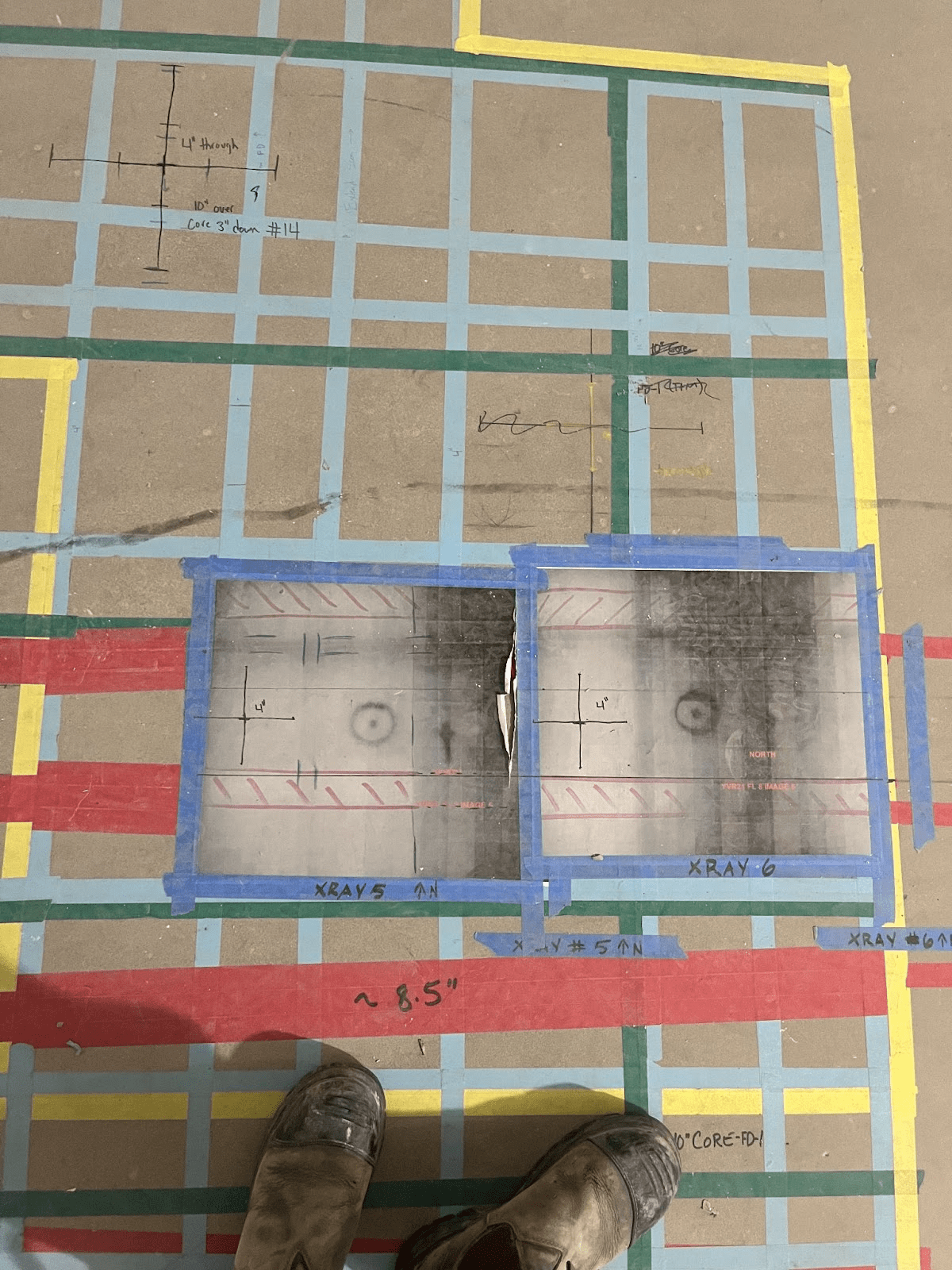
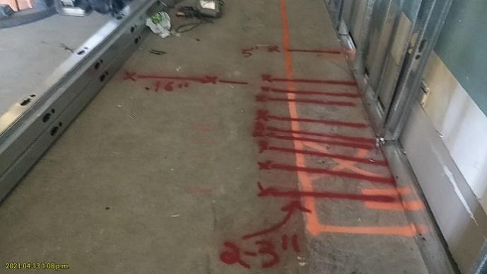
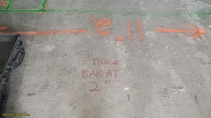
When inconsistencies were detected in the radar data, the team promptly flagged the need for further analysis. Xradar accurately interpreted the radargram, identifying the slab as suspended rather than slab-on-grade.
By distinguishing between air gaps (indicating a suspended slab) and soil beneath the slab (typical of slab-on-grade), we were able to provide the client with the correct information. The team’s proactive approach to verifying site conditions prevented critical errors, and a subsequent visual inspection confirmed the presence of a parking level below the unit.
Methodology
The team employed Ground Penetrating Radar (GPR) technology to scan the subsurface of the slab. We utilized Xradar™, known for its accurate readings of subsurface elements and slab conditions. Key steps in the process included:
- Conducting a site walkthrough to visually inspect the surroundings.
- Interpreting the radargram to identify anomalies, such as air gaps beneath the slab, which suggested the presence of a suspended slab.
- Re-evaluating the data when inconsistencies arose between the expected slab type and the radar signals, followed by a secondary inspection of the area.
Results/ Conclusion
Conclusion
By accurately identifying the slab type and delivering precise subsurface mapping, we averted a potential structural disaster. Our proactive approach to scanning, combined with advanced GPR technology, ensured that the project could move forward safely, preventing errors and delays.