Building Information Modeling (BIM)
REQUEST PROJECT ESTIMATE
Discuss your project scope with our Estimating team, for a free estimated cost.
Project EstimateLocations Offered
Toronto
Montreal
Vancouver
Quebec City
Ottawa
Calgary
Nova Scotia
Malaysia & Singapore
SERVICE OVERVIEW
At Xradar, we specialize in providing highly accurate Building Information Modeling (BIM) services powered by industry-leading laser scanning technology. Our reality capture solutions deliver precise, real-world site data that forms the foundation for smarter design, efficient construction, and long-term asset management. With Xradar, you gain the advantage of true-to-site digital models that reduce risk, streamline collaboration, and drive better project outcomes.
Methods & Technology
Xradar™ Enhanced Concrete Scanning
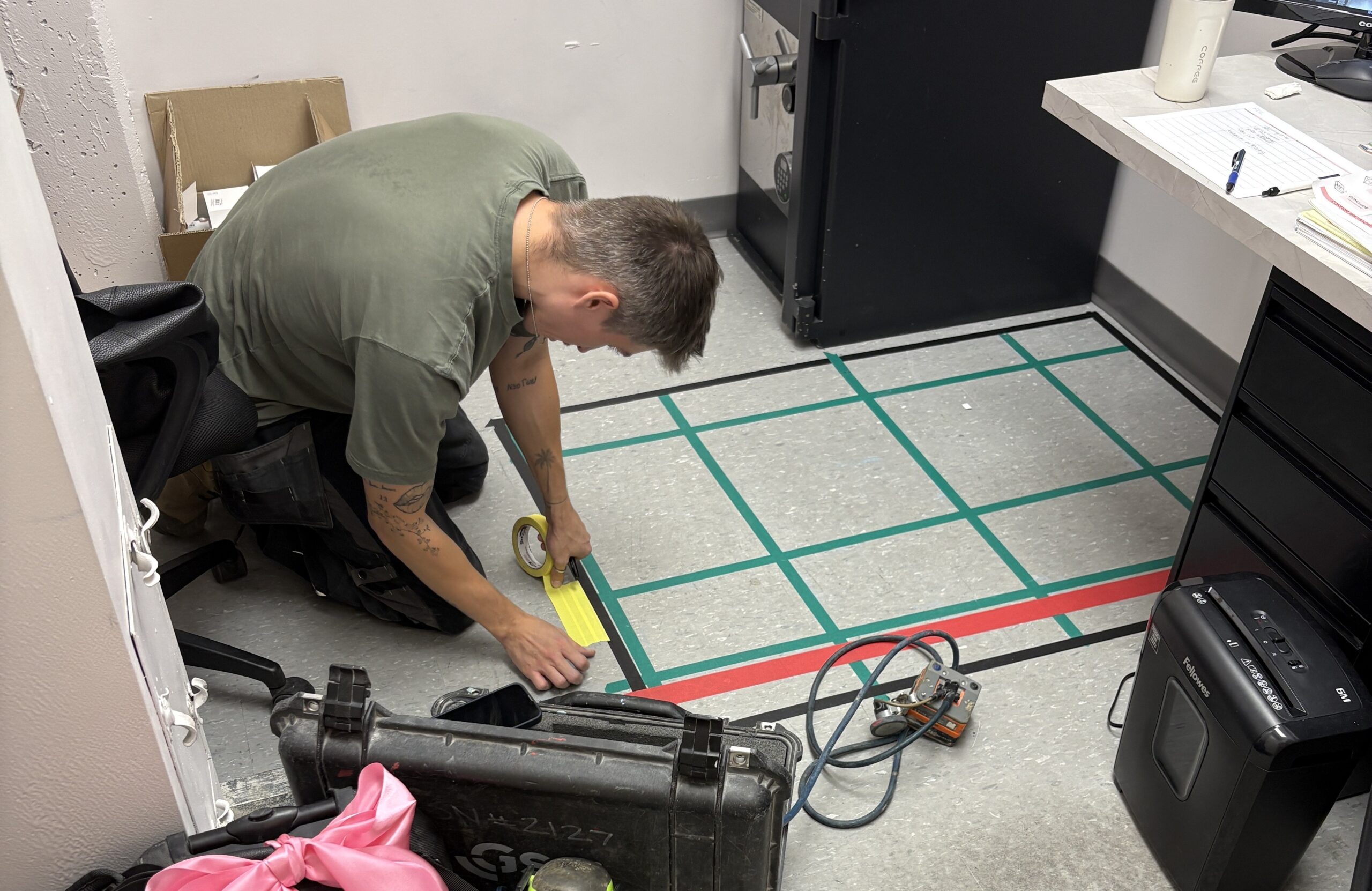
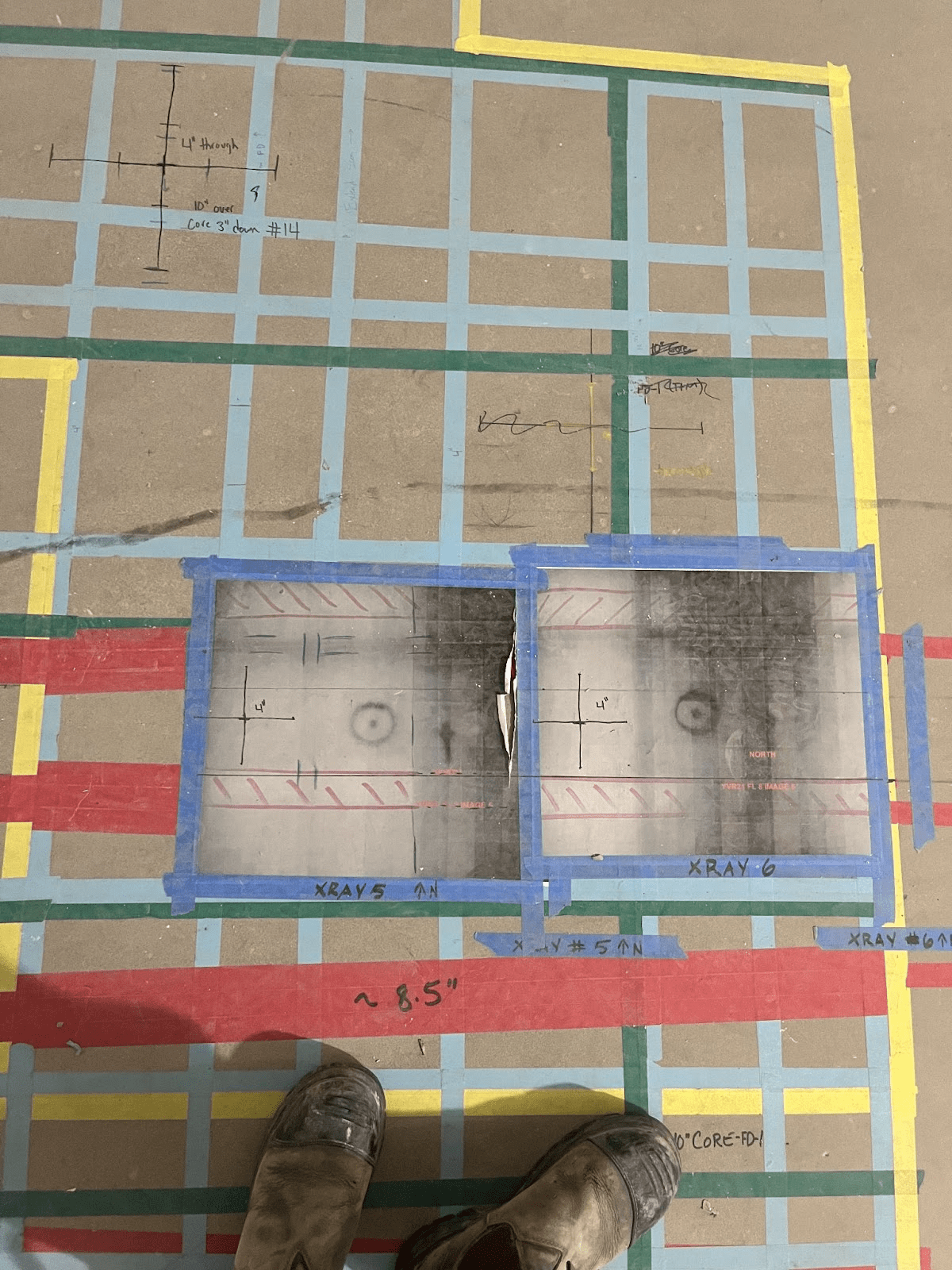
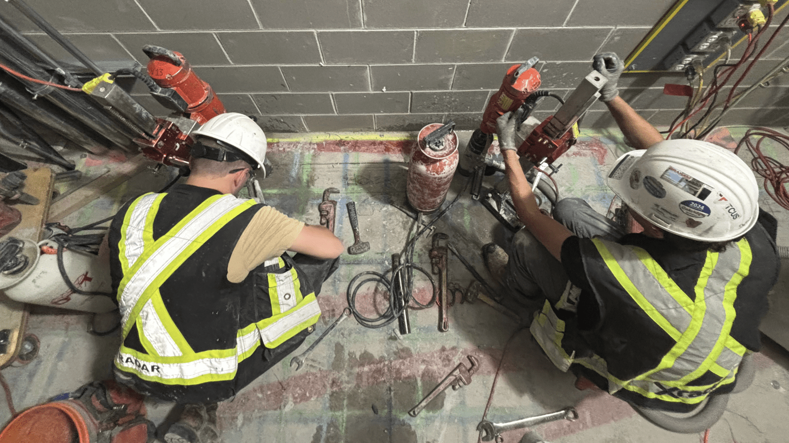
Xradar™ is an advanced imaging capability, utilizing GPR (Ground Penetrating Radar) technology that provides high-resolution subsurface imaging for safe, precise concrete scanning and utility detection.
Learn About Xradar™Laser Scanning
Laser Scanning captures exact as-built conditions for design, analysis, and documentation
Explore Laser ScanningHeading
Benefits
Our BIM Services
Reality Capture for BIM Workflows
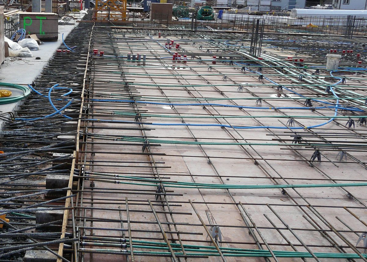
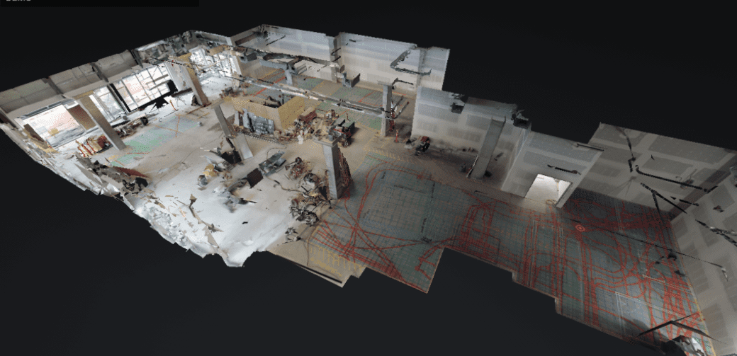
Using advanced laser scanning systems, Xradar captures millions of data points—known as a point cloud—to digitally replicate structures with exceptional accuracy. Our scans can capture critical details of an existing structure (such as slab dimensions, wall locations, column positioning), as well as pre-design site conditions to allow for effective design, planning, and clash detection.
Accurate As-Built Documentation
We deliver comprehensive, survey-grade data essential for retrofit projects, design validation, renovations, and new construction planning. By working with precise as-built information, design and construction teams can make informed decisions at every project stage.
Data Integration and Coordination
Xradar’s laser scanning services support BIM workflows by delivering reliable information that enhances collaboration across architecture, engineering, and construction teams. Our solutions help identify conflicts early, reduce design errors, and minimize costly site changes or schedule delays.
The Power of ‘Information’ in BIM
The ‘i’ in BIM
Building Information Modeling is more than just 3D design – it is a collaborative process where all stakeholders within the construction and lifecycle of a building are able to contribute to and access key data. The real strength of BIM lies in the ‘i’: Information.
Storing information is key to these processes, but the further strength is in its usability. From initial concept through to completion, and beyond, BIM data helps ideate concepts, improve accuracy, communicate design intent, and reduce costly changes and coordination issues. This can help support future projects such as renovations.
How is BIM Data Shared
BIM is typically managed through a shared digital platform such as Common Data Environment (CDE). This hub allows all stakeholders to access and contribute to the ‘information model’. In time this evolves into a dataset that spans the entire lifecycle of the asset, from design, to operation and eventually to upgrades.
BIM levels are crucial for standardizing processes and aligning stakeholders, ultimately improving collaboration, reducing errors, and enhancing project outcomes. There are two levels of BIM that are often referred to: BIM Maturity and Level of Detail.
Benefits
Why BIM and Reality Capture Matter
Minimize Risk
Identify potential issues before construction begins by working from true-to-site
conditions.
Enhance Project Coordination
Improve collaboration and communication across all project stakeholders with a shared,
reliable data source.
Reduce Site Visits
Access full digital site documentation anytime, reducing the need for multiple physical
inspections.
Maximize Long-Term Value
Maintain accurate records for facility management, maintenance planning, and future
upgrades.
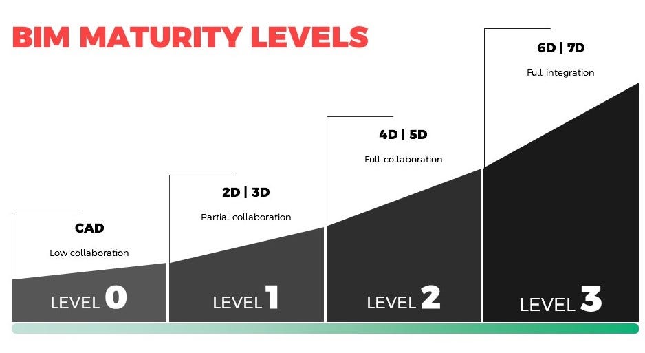
Maturity (or Adoption) Level Model
The Maturity Level Model acts as a tool for measuring an organization’s or project’s BIM capability, indicating areas for improvement in workflows and technology integration.
These levels typically range from 0 to 3, defining how well BIM is used, from basic 2D documentation to fully integrated and collaborative 3D models with real-time data exchange.
Here’s a breakdown of the common BIM levels:
– Level 0 (Low Collaboration; No BIM): This level involves basic 2D CAD drawings and minimal to no collaboration, often described as unmanaged CAD.
– Level 1 (Partial Collaboration; BIM for visualization): Level 1 utilizes managed 2D or 3D CAD, with some collaboration, primarily for visualization purposes.
– Level 2 (Full Collaboration; BIM for visualization, collaboration, and data management): Level 2 involves full collaboration, using shared 3D models and incorporating data management.
– Level 3 (Full Integration): Level 3 represents the highest level of BIM maturity, integrating all processes and data into one fully collaborative and interoperable system.

Level of Development (LOD)
LOD specifies the level of detail and accuracy in BIM models throughout different project phases, ranging from LOD 100 (concept) to LOD 500 (as-built).
Models created are always required at a specific level of development (LOD). LOD is a high level overview that specifies the model progression by outlining what model geometry are required for specific scopes of work. It describes how a model will evolve from the earliest stage of design, concept, through to construction completion. All LOD requirements for each element type shall be reviewed and agreed upon at the start of the digital construction process. Below are visuals of the different LOD. Get in touch if you’d like to learn more.
Revit Modeling Services
When required, Xradar can process point cloud data into Revit models, providing intelligent, parametric 3D representations of your structures. Our Revit deliverables include the accurate modeling of visible building elements—such as slabs, walls, beams, and columns—directly informed by precise laser scans. Subsurface details, such as rebar, conduits, and corrosion mapping, are documented separately to maintain clarity within your BIM workflow.